
1
/
of
1
Delorme Mapping Company
Delorme Atlas & Gazetteer: Connecticut & Rhode Island by Rand McNally
Delorme Atlas & Gazetteer: Connecticut & Rhode Island by Rand McNally
Regular price
$29.95 USD
Regular price
$29.95 USD
Sale price
$29.95 USD
Shipping calculated at checkout.
Quantity
Low stock: 10 left
Couldn't load pickup availability
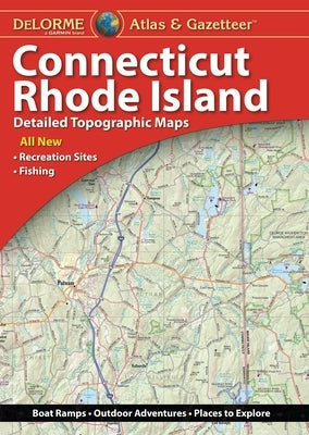
With an incredible wealth of detail, DeLorme's Atlas & Gazetteer is the perfect companion for exploring the Connecticut and Rhode Island outdoors. Extensively indexed, full-color topographic maps provide information on everything from cities and towns to historic sites, scenic drives, trailheads, boat ramps and even prime fishing spots. The Atlas & Gazetteer is your most comprehensive navigational guide to the backcountry of Connecticut and Rhode Island. - Full-color topographic maps provide information on everything from cities and towns to historic sites, scenic drives, recreation areas, trailheads, boat ramps and prime fishing spots. - Extensively indexed. - Handy latitude/longitude overlay grid for each map allows you to navigate with GPS. - Inset maps provided for major cities as well as all state lands. Product Details: Connecticut & Rhode Island. Dimensions: 15.5" x 11".
Author: Rand McNally
Publisher: Delorme Mapping Company
Published: 08/01/2023
Binding Type: Other
Weight: 1.00lbs
Size: 15.00h x 11.40w x 0.70d
ISBN: 9781946494726
Author: Rand McNally
Publisher: Delorme Mapping Company
Published: 08/01/2023
Binding Type: Other
Weight: 1.00lbs
Size: 15.00h x 11.40w x 0.70d
ISBN: 9781946494726
Share
No reviews