
1
/
of
1
Rand McNally
Rand McNally Folded Map: Jacksonville Street Map by Rand McNally
Rand McNally Folded Map: Jacksonville Street Map by Rand McNally
Regular price
$8.99 USD
Regular price
$8.99 USD
Sale price
$8.99 USD
Shipping calculated at checkout.
Quantity
Low stock: 1 left
Couldn't load pickup availability
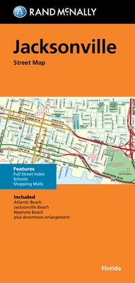
Rand McNally's folded map for Jacksonville is a must-have for anyone traveling in and around this part of Florida, offering unbeatable accuracy and reliability at a great price. Our trusted cartography shows all Interstate, U.S., state, and county highways, along with clearly indicated parks, points of interest, airports, county boundaries, and streets. The easy-to-use legend and detailed index make for quick and easy location of destinations. You'll see why Rand McNally folded maps have been the trusted standard for years. - Regularly updated. - Full-color maps. - Clearly labeled Interstate, U.S., state, and county highways. - Indications of parks, points of interest, airports, county boundaries, schools, shopping malls, downtown & vicinity maps. - Easy-to-use legend. - Detailed & full street index. - Convenient folded size. Coverage Area Communities Included: Atlantic Beach, Jacksonville Beach, Neptune Beach plus downtown enlargement. Product Details: Measures 9.5 x 4 and folds out to 40 x 28.
Author: Rand McNally
Publisher: Rand McNally
Published: 05/23/2022
Binding Type: Folded
Weight: 0.95lbs
Size: 8.90h x 4.40w x 1.30d
ISBN: 9780528024993
Author: Rand McNally
Publisher: Rand McNally
Published: 05/23/2022
Binding Type: Folded
Weight: 0.95lbs
Size: 8.90h x 4.40w x 1.30d
ISBN: 9780528024993
Not available to be shipped via Media Mail
Share
No reviews